Knowing how to read a map is a necessary skill
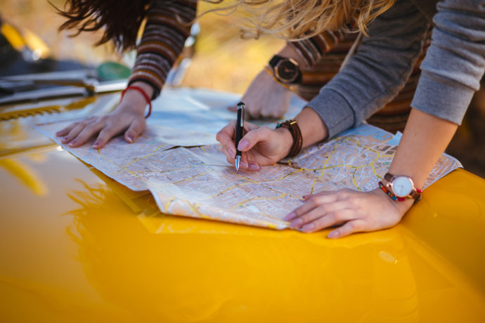
With all the technology available to us, we may wonder why we need to know how to read a map at all. We’re RVers, and that means many adventures await us. Some of those adventures will take us to places without reception or a connection to GPS apps or online maps. Imagine being stuck on a side road out in the middle of nowhere. You’re sure you took a wrong turn somewhere, but you can’t remember precisely where. You’re stuck, and there’s no reception to help you find the best way back to your route. This is precisely why knowing how to read a map is essential.
Not created equal
Not all maps are created equal. This isn’t to say they won’t get the job done, but the jobs they perform vary depending on the map. Different maps will show you different things. Physical maps will show you the various natural features of a location, political maps will show you the boundaries of countries and where cities are located, economic maps will show you where resources are located, and road maps will show you the roads that wind their way through an area. Obviously, it’s the road map you’ll want on hand when you venture into an area. Each map is titled, so you’ll know at a glance what the map is going to tell you.
Legend
At a glance, you may be confused by what all the elements and symbols on a map are trying to tell you. It would be a mess if everything were written out on the map, and anyone reading it would quickly become confused.
The legend on the map will indicate what each individual symbol is trying to tell you. The symbols can change depending on what country you’re in. If you’re traveling to Canada, for example, the symbols may depict other elements, so always check the legend.
Which direction?
A map will have a compass point on it depicting north. If it doesn’t, typically the top of the page will be north. All you need to know is where north is situated in relation to where you are, and you’ll be able to tell which direction you need to go in accordance with the map.
Distance
Obviously, the map is scaled for distance. You’re not carrying around a giant map with real distances mapped out. On the map, you’ll find an indication of how many miles are covered within a certain length. It’s most likely that 1 inch will cover many miles, and you can determine how far away something is by how many inches are between where you are and where your destination is on the map.
Colors
What are the colors telling you? Typically, open space, such as grasslands and open land, will be white. Green indicates woodlands, and blue is telling you there’s a body of water located there.
Location lines
Latitude and longitude lines circle Earth. With them, you can determine the exact point you’re at on a map. Longitude will run vertically from north to south, while latitude will run horizontally across the map from east to west. Where these two lines meet provides the precise point of your location. This is handy if you need help and happen to get reception or have a walkie-talkie.
Where to?
It’s difficult to read a map if you don’t know where you are. Knowing where you are is imperative to getting where you need to go. If you’re on a road, you can look for signs that tell you which road you’re on, in which direction you’re going, or which mile marker you’re near (if you’re on a highway). Use whatever you can on the map and in your environment to pinpoint where you are, and then find where you want to go. Locate the roads that will take you there, and you’ll be set!
Not knowing how to read a map isn’t the only issue you can run across on your adventure. Sometimes we hit something that damages our tires or wheels. With luck, you’ll have tire and wheel protection from the RV Advisor. If you don’t have our tire and wheel protection plan yet, make sure you order yours before you hit the road!
